Walnut Grove Langley · A guide for buyers and owners
Walnut Grove, north of Highway 1 in Langley, is a neighbourhood built mostly in the 1980s, with creek ravines running between its streets.
- 1Save-On-Foods
- 2Redwood Medical Clinic
- 3Langley Township Fire Hall 8
- Creek and ravine land the Township protects
What Walnut Grove is like
Most of Walnut Grove’s streets were laid in one decade: the ’s road records date 78% of their length to the 1980s, against 1% of Willoughby’s.
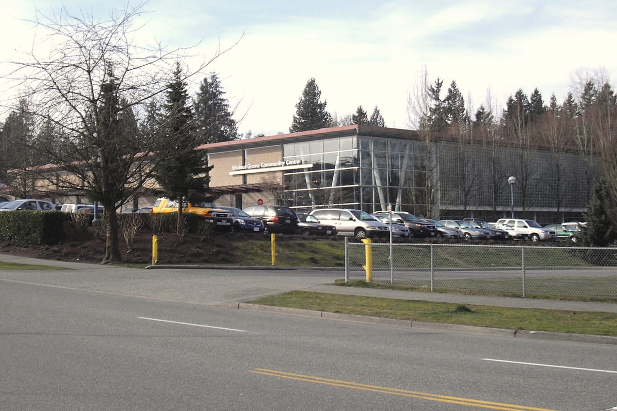
Its hub is the Walnut Grove Community Centre at 8889 Walnut Grove Drive, which shares its address with the Dean Drysdale Library.
Walnut Grove homes and lots
A Walnut Grove house lot is 6,100 square feet. That is 25% smaller than Murrayville’s and 51% bigger than Willoughby’s.
Most are under 8,000 square feet: 82% of the house lots here.
A typical Walnut Grove lot is 57 × 107 feet, about 6,100 square feet.
The rear yard behind a 1,000 square foot house on the front setback line is 47 feet deep, about 2,700 square feet.
An acre holds about 7 typical Walnut Grove lots.
Frontage and depth are the median sides of the house lots within 10% of the median area, to the foot. Setbacks are the minimums for a lot entered from the street, in the zone most lots this size are in: the compact-lot zone, front 6.0 m, rear 3.0 m, side 1.2 m (s.403.8(1)); R-1A to R-1E, front 6.0 m, rear 3.0 m, side 1.2 m (s.401.5(1) and s.402.4(1)). The house is an example, not a fact about the area: 2,000 square feet over two floors, no garage. North is drawn up only to read the plan. Source: Township of Langley parcel outlines and Zoning Bylaw 2500, parcels measured October 21, 2026. Believed accurate, not guaranteed.
Creeks and ravines in Walnut Grove
Creek ravines touch more of Walnut Grove than its neighbours: 8% of house lots here touch protected creek land, against 2% in Brookswood-Fernridge and none in Murrayville.
Beside a natural creek the Township keeps a strip of land free of building, measured from the top of the bank. How wide depends on whether the creek is class A or class B on the Township’s watercourse map.
| Creek class | Usual width | Narrowest allowed |
|---|---|---|
| Class A | 30 | 25 |
| Class B | 20 | 15 |
A strip can shrink to its narrowest allowed width only if three things hold. It widens elsewhere, so its average width stays the same. Twice the area given up is restored. An environmental professional’s report supports it.
The Township sets the strip when an owner applies to rezone, subdivide or develop. Walnut Grove’s 1979 community plan also bars building, fill and soil removal within 7 metres of a ravine’s top.
Source: Township of Langley open data, streamside brochure and Walnut Grove Community Plan, 18 October 2026. Believed accurate, not guaranteed.
Walnut Grove house prices
A typical Walnut Grove detached house cost $1.30M in October 2026, less than in Willoughby, by the of the .
Source: Fraser Valley Real Estate Board, October 2026. Believed accurate, not guaranteed.
The Walnut Grove figure is down 6.9% on a year earlier.
A townhouse here cost 59% of the detached benchmark, and a condo 40%.
Source: Fraser Valley Real Estate Board, October 2026. Believed accurate, not guaranteed.
Source: Fraser Valley Real Estate Board, benchmark price by month, the past ten years. Believed accurate, not guaranteed.
Townhouses sell here about as often as detached houses: in the year to October 2026, detached houses were 44% of sales and townhouses 43%. In Willoughby only 18% were detached.
Walnut Grove homes for sale
No detached homes are among the newest homes for sale in Walnut Grove.
Living in Walnut Grove
Nearly every home here is in one high school’s : Walnut Grove Secondary covers 99% of the land.
Elementary catchments split the land six ways; the largest is Alex Hope’s.
Source: Langley School District catchment maps, 18 October 2026. Believed accurate, not guaranteed.
Langley Memorial Hospital is a 12 to 17 minute drive on clear roads from homes across Walnut Grove, against 2 to 6 minutes from Murrayville.
Source: OpenStreetMap road data, routed from 24 homes spread over the community, 18 October 2026. Believed accurate, not guaranteed.
Before you buy
- A home beside a creek or ravine: the strip that cannot be built on, 15 to 30 metres from the top of the bank by the creek’s class. The Township’s streamside rules
- A townhouse or apartment: the strata’s report on repairs ahead, and its insurance. Strata insurance guide
- More than one home on a lot: the rules turn on the lot’s size and on Township sewer, which 97% of house lots here have. More than one home on a Langley lot
- The provincial transfer tax, paid on the price when the home is registered to you. Transfer tax calculator
Selling a Walnut Grove home
Detached houses took 25 days to sell here against 34 in Willoughby, and townhouses took longer.
Source: Fraser Valley Real Estate Board sold-home statistics, year to October 2026. Believed accurate, not guaranteed.
If your lot touches protected creek land, know the strip’s width before you set a price: the table under Creeks and ravines gives it by creek class.
What is my home worth?Net proceeds calculatorSelling checklist
The monthly letter
Once a month I write up the Fraser Valley market and what it means if you are weighing a move.
Working with me

Bronson Job PRECMomentum Realty Inc.
If you’re looking at homes in Walnut Grove, I’d be glad to represent you as your REALTOR® and set up tours.
If you own in Walnut Grove and are thinking of selling, I’d be glad to help you price it and sell it.
Call, text or email
778-867-2766bronson@bronsonjob.comSend a message
I’m Bronson Job, a REALTOR® (PREC) with Momentum Realty Inc., so I earn a commission when I help someone buy or sell. These guides are general information, not advice on your specific situation, and I take no payment from any third party named in them. How I verify
Keep reading
Sources (13)
- Community boundary, detached lots, lot sizes, water and sewer connections, creek and ravine land, school grounds and street records: Township of Langley open data (Communities, Parcel Attributes, Conservation_Areas, Drainage_Channels, Parks, Roads), Open Government License - Township of Langley, measured 18 October 2026. A lot touches protected land when its outline meets a conservation area; the creek counts use detached lots zoned R-1A to R-1E or SR-1 to SR-3 whose point is inside the boundary; a street is counted by its midpoint and weighted by length, by the year the Township added it to its road records. The same queries were run for Willoughby, Murrayville and Brookswood-Fernridge. Walnut Grove lies north of Highway 1 on the Communities layer. Township of Langley open data
- Median house lots: Township of Langley open data, Parcel Attributes; every detached house zone (R-1x, SR-x, R-CL compact lots, not their row-house, semi-detached or manufactured-home variants); parcel outline area in square feet; median to the nearest 50; one rule for every area. Walnut Grove 3,783 house lots, median 6,100 sq ft, 25% smaller than Murrayville and 51% bigger than Willoughby; Murrayville 8,150 sq ft, Brookswood-Fernridge 10,850 sq ft, Willoughby 4,050 sq ft. Lots under 8,000 sq ft: Walnut Grove 82%, Murrayville 48%, Brookswood-Fernridge 15%, Willoughby 85%. Measured 18 October 2026.
- Lot plans: frontage and depth are the median shorter and longer side of the house lots within 10% of each place's median area, fitted with their smallest enclosing rectangle on the Township of Langley's parcel outlines (open data, Parcel Attributes, measured 2026-10-21) and given to the nearest foot. Setbacks are the minimums for a principal building on a lot entered from the street in Township of Langley Zoning Bylaw 1987 No. 2500, as amended by Bylaw 6020: R-1A s.401.5(1), R-1B to R-1E s.402.4(1), R-CL s.403.8(1), SR-1 to SR-3 s.301.5(1), s.302.4(1) and s.303.4(1). The house (1,000 square feet on each of two floors) and the yard behind it are an example worked out from those numbers.
- Streamside strip: Township of Langley, Streamside Protection and Enhancement brochure, last updated April 2017, read 18 October 2026. Class A natural watercourse 30 metres, narrowest allowed 25; class B natural watercourse 20 metres, narrowest allowed 15; measured from the top of the bank. The narrowest figure applies only through the brochure's flex provision: the average width must still equal the full width, and enhancement of twice the area of strip given up is required, with a report from a qualified environmental professional. The strip is set when an owner applies for a plan amendment, rezoning, subdivision or development permit, and may be applied at a building permit or soil permit where none of those came first. Class A watercourses are drawn red, orange or magenta on the Township's watercourse classification map, class B yellow. the brochure
- Walnut Grove Community Plan, Bylaw 1978 No. 1836, adopted 26 November 1979, consolidated for convenience, read 18 October 2026. Section 2.4.1(a): no buildings, fill or soil removal within 7.0 metres of the top of ravines or natural watercourses. the plan
- Benchmark prices, sales and year-on-year change: Fraser Valley Real Estate Board, October 2026, through the site’s market snapshot; sales are the 12 months to October 2026. Detached benchmark: Walnut Grove $1.30M ($1,296,700), Willoughby $1.42M ($1,422,300); Walnut Grove detached down 6.9% on a year earlier, 9% ($125,600) below Willoughby. Walnut Grove townhouse $770,500 (59% of the detached benchmark), condo $517,600 (the board’s apartment benchmark, 40% of the detached one). Average days to sell over the twelve months: Walnut Grove detached 25, townhouse 38, apartment 43; Willoughby detached 34, townhouse 28. Sales in Walnut Grove: 139 detached, 135 townhouse and 39 condo (the board’s apartment series), 313 in all (detached 44%, townhouses 43%); in Willoughby 212, 526 and 455, 1,193 in all (detached 18%).
- Drive to Langley Memorial Hospital: 24 homes spread evenly over the boundary, routed on clear roads with OpenStreetMap road data and the Open Source Routing Machine, 18 October 2026: 12 to 17 minutes, 9 to 12 kilometres; Murrayville, measured the same way, 2 to 6 minutes. OpenStreetMap
- School catchments: Langley School District catchment maps, shares of the community’s land to the nearest five percent, 18 October 2026. Walnut Grove Secondary 99% of the land; elementary Alex Hope 25%, Dorothy Peacock 20%, James Kennedy 20%, Gordon Greenwood 15%, West Langley 15%, Topham 10%. Langley School District
- Places on the map: OpenStreetMap contributors (Save-On-Foods, Redwood Medical Clinic, Fire Hall 8, Walnut Grove Community Centre and Dean Drysdale Library at 8889 Walnut Grove Drive), 18 October 2026. OpenStreetMap
- Photo: Walnut Grove Community Centre, 2014, James.bc, Creative Commons Attribution-ShareAlike 3.0, via Wikimedia Commons, cropped and colour-balanced. the Commons file
- Figures on this page. Streets: 78% of Walnut Grove's local street length added in the 1980s, median year 1984; Willoughby 1% (median 2008), Brookswood-Fernridge 20% (1974), Murrayville 0% (1994). Creeks: 293 of 3,609 (8%, about one in twelve) detached lots touch protected land, against 93 of 4,262 (2%) in Brookswood-Fernridge, 11 of 1,099 (1%) in Willoughby and 0 of 1,744 in Murrayville. Sewer and water: 3,508 and 3,504 of 3,617 detached lots (97% on Township sewer).
- Home type: the toggle at the top switches the price, its history and the homes for sale to a detached house, a townhouse or a condo, each worked out the same way from that type’s benchmark for the Walnut Grove region, October 2026: detached $1,296,700, example price $1,295,000; townhouse $770,500, example price $770,000; condo (the board’s apartment benchmark) $517,600, example price $520,000. The page opens on detached houses, the type that sold most in the past twelve months.
- Price history: the board’s benchmark price, month by month for ten years, from the site’s Market Insights (the board’s monthly statistics, filled from the Canadian Real Estate Association where the board has no month).
Last checked 18 October 2026. Text and figures are licensed Creative Commons Attribution 4.0.