Cloverdale (Surrey) — A Buyer’s Guide
A note from me: I’m Bronson Job, a REALTOR® (PREC) with Royal LePage Ben Gauer & Associates, so I earn a commission when I help someone buy or sell. I write these guides to be genuinely useful — general information, not advice on your specific situation — and I take no payment from any third party named in them. How I verify.
Cloverdale is the southeast corner of the City of Surrey — a historic Town Centre of brick storefronts and older detached homes, set against the Clayton corridor immediately east, one of Surrey’s most townhouse-build-heavy zones over the past decade. The Surrey–Langley SkyTrain extension runs through it along Fraser Highway, with a Clayton station and a 166 Street station both currently targeted to open in late 2029. This is a block-by-block buyer’s guide to the four enclaves, the schools, the transit picture, and the housing stock. It pairs with the Cloverdale area page and the Clayton area page — those pages are the live market snapshots, this one is the slower read.
Market snapshot · May 2026
Cloverdale · HPI Benchmark
Benchmark price
$955K
Month over month
-0.4%
Year over year
-8.1%
Sales (month)
74
Active listings
445
Months of inventory
6.2
Fraser Valley Real Estate Board / Greater Vancouver REALTORS composite Home Price Index (HPI) — the industry-standard measure of typical home value, adjusted for property mix. Easing supply (buyers gain leverage).
See the Cloverdale HPI chart on Market Insights
Source: Fraser Valley Real Estate Board · Real Estate Board of Greater Vancouver. Composite (all property types). HPI benchmarks are aggregate measures — specific properties may transact above or below.
What Cloverdale offers
Cloverdale offers two distinct experiences in one postal area. The Town Centre is a walkable historic high street — brick storefronts, the Surrey Museum, the Cloverdale Fairgrounds, and the longest-running rodeo in Canada anchored at the same park each Victoria Day weekend.
Immediately east, Clayton is one of the Lower Mainland’s deepest pools of post-2010 townhouse inventory, with two future SkyTrain stations along Fraser Highway scheduled to open in late 2029. The Town Centre is the character side; Clayton is the new-build side. Same school district, same Fraser Valley Real Estate Board macro-area, different housing stock and price-per-square-foot.
Inside Cloverdale
Cloverdale is not one neighbourhood — it is four enclaves with different inventory vintages, different SkyTrain station proximity, and different price-per-square-foot benchmarks. The City groups them as “Cloverdale” for Open Data and Fraser Valley Real Estate Board (FVREB) macro-area F40 reporting, but the on-the-ground experience differs between the historic 1990s Town Centre and the post-2010 Clayton corridor immediately east. Recognised sub-pockets the City acknowledges include Cloverdale Town Centre, West Clayton, East Clayton, Hillcrest, Salish Plateau, and the Cloverdale Hills / Hyland enclaves to the west.
Cloverdale Town Centre
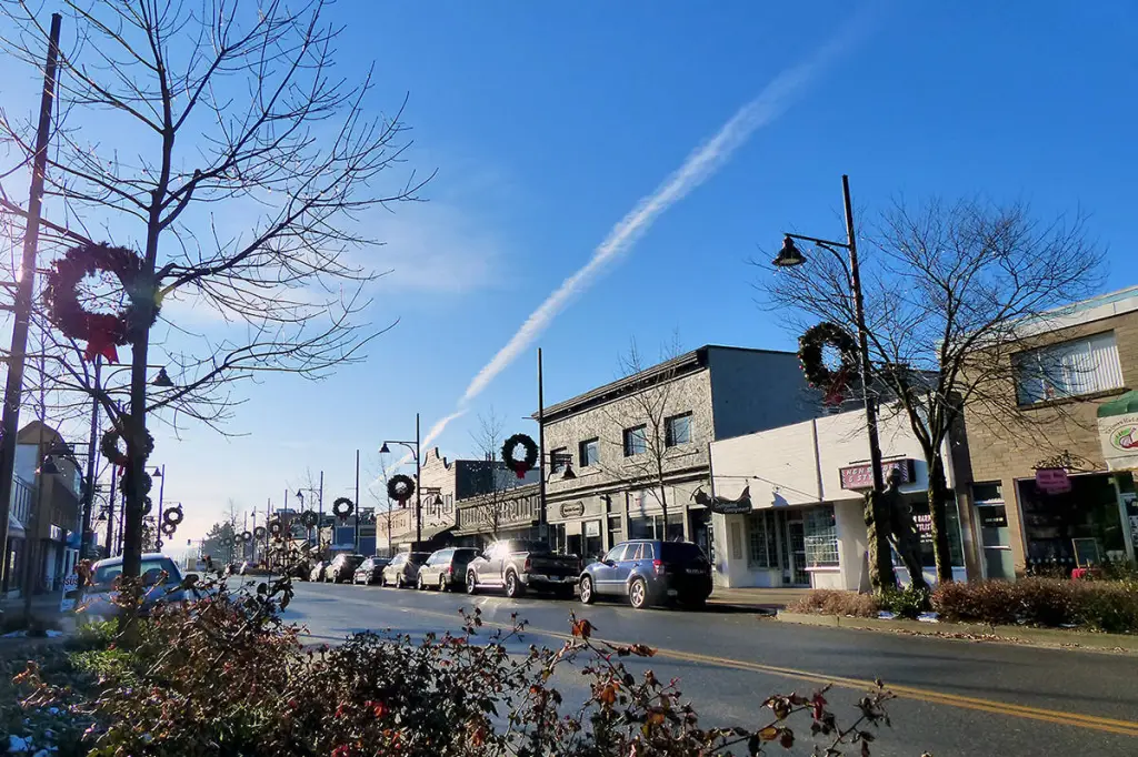
Cloverdale Town Centre is the historic core at 176 Street and 60 Avenue — brick storefronts along the high street, the Surrey Museum, the Cloverdale Heritage District, and Cloverdale Fairgrounds (home of the annual Cloverdale Rodeo and Country Fair, a Victoria Day weekend tradition continuously since 1888). Inventory leans older detached on conventional 6,000–8,000 sq ft lots built between the 1960s and 1990s, with incremental infill replacement underway. The Town Centre Official Community Plan (OCP) envisions mid-rise density along the high street, but actual built form has been slow — most new units have come from townhouse and infill detached, not high-rise.
Clayton (West Clayton)
Clayton is the new-construction corridor immediately east of 184 Street, anchored on the Clayton Heights commercial node around 184 Street and 70 Avenue along Fraser Highway. Inventory is post-2010 townhouses (the dominant product), with newer detached on smaller 4,500–5,500 sq ft lots and recent multi-family condo developments. Clayton has been one of Surrey's most townhouse-build-heavy zones over the past decade — analogous to Yorkson / Willoughby in Langley but two corridor-stops west. The future Surrey-Langley SkyTrain Clayton Station along Fraser Highway (currently targeted late 2029) is the variable shaping medium-term valuation here.
East Clayton
East Clayton is the eastern half of the Clayton corridor, running roughly from 188 Street to the Surrey-Langley boundary at 196 Street, south of 72 Avenue. Inventory is similar to West Clayton — post-2010 townhouses dominate, with newer detached on smaller lots and a meaningful share of the corridor's newest condo developments. School District 36 (SD #36) catchments lean Clayton Heights Secondary; elementary feeders include Hazelgrove and Katzie. The future SkyTrain station impact is most direct here because of the proximity to Fraser Highway.
Cloverdale Hills (West Cloverdale)
West Cloverdale (sometimes called Cloverdale Hills) is the older detached enclave roughly between Highway 10 and 60 Avenue, west of 176 Street. Detached homes built 1970s through 1990s on conventional 6,500–8,500 sq ft lots, mature trees, established blocks. The redevelopment edge along the BC Hydro corridor and infill along 60 Avenue has produced a meaningful supply of newer detached and townhouse stock. Pricing tracks the older inventory — Cloverdale Town Centre detached comps run lower than comparable Clayton newer detached because the lots are older and the kitchens and baths typically have not been refreshed.
Schools — the catchment math
Cloverdale and Clayton fall within School District 36 (SD #36 / Surrey), with two distinct secondary catchments: Lord Tweedsmuir Secondary handles Cloverdale Town Centre and west Cloverdale; Clayton Heights Secondary handles the Clayton corridor. Common elementary feeders include Cloverdale Traditional (application-based, district-wide draw), Hillcrest, George Greenaway, Don Christian, Pacific Heights, Hazelgrove (West Clayton), Katzie (East Clayton), and Sunrise Ridge (north Clayton). Cloverdale Catholic School is a private K-7 option for families considering Catholic education.
Cloverdale Traditional Elementary is one of SD #36’s traditional-program elementary schools — structured curriculum, dress code, application-based enrolment, district-wide draw rather than residential catchment. Spots are limited; the application runs annually and demand typically exceeds capacity. For families specifically choosing Cloverdale for the traditional program, decouple the residency decision from the admissions decision — apply first, move second, not the other way around.
SD #36 catchment maps are reviewed periodically — verify the current attendance area for any specific Cloverdale or Clayton address before placing an offer. Boundary lines run through the Clayton corridor — a one-block move can change the elementary feeder.
The SkyTrain corridor — Cloverdale + Clayton stations, late 2029
The Surrey-Langley SkyTrain extension is a 16-kilometre elevated guideway running along Fraser Highway with 8 stations terminating at Langley City Centre (203 Street). Two stations serve the Cloverdale corridor: the 166 Street station (near Cloverdale, west of the Town Centre) and Clayton Station (190 Street and Fraser Highway). The Province confirmed in January 2026 that in-service is targeted for late 2029 (pushed back from earlier 2028 estimates).
The 800-metre radius around each SkyTrain station is the typical window for station-premium pricing. East Clayton townhouses immediately south of Fraser Highway sit closest to the new Clayton Station; West Clayton is mixed-radius; Cloverdale Town Centre detached north of Highway 10 sits outside the walkability radius and benefits more indirectly.
Worked examples
Example 1 — Cloverdale Town Centre 1992-build detached at $1.55M
4-bedroom 2,300 sq ft detached on a 7,200 sq ft conventional lot, 1992 build, original-condition kitchen and baths. West of 176 Street, walking distance to the heritage core and the Surrey Museum. Hillcrest Elementary catchment, Lord Tweedsmuir Secondary feeder. Property Transfer Tax (PTT): 1% × $200K + 2% × $1.35M = $2K + $27K = $29K. Canada Mortgage and Housing Corporation (CMHC) default insurance not available (above $1.5M cap, so 20% down required: $310K). Total cash to close ex-mortgage: ~$310K down + $29K PTT + ~$3K legal + ~$1K title insurance = roughly $343K. Bill 44 Small-Scale Multi-Unit Housing (SSMUH) multiplex eligibility: in principle yes, but verify lane access and servicing — older Cloverdale lots vary in real-world buildability.
Example 2 — East Clayton 2018-build townhouse at $980K (inside 800m of future Clayton Station)
3-bedroom 1,580 sq ft three-storey townhouse, 2018 build, 600 metres south of the future Clayton Station along Fraser Highway. Hazelgrove Elementary catchment, Clayton Heights Secondary feeder. PTT: 1% × $200K + 2% × $780K = $2K + $15.6K = $17.6K. First-Time Home Buyer (FTHB) exemption: not applicable (above the $835K full-exemption threshold). Newly-built exemption: not applicable (over 5 years from build). CMHC default insurance available for sub-20%-down. Strata fee typically $300–$420/mo for newer Clayton townhouses; verify the depreciation report. The station-radius premium is partially priced in at this entry point.
Example 3 — West Clayton 2020-build detached at $1.78M
4-bedroom 2,650 sq ft detached on a 4,800 sq ft small-lot, 2020 build, 1.2 km from the future Clayton Station (outside the 800m walkability radius but inside the corridor halo). Hazelgrove Elementary catchment, Clayton Heights Secondary feeder. PTT: 1% × $200K + 2% × $1.58M = $2K + $31.6K = $33.6K. Newly-built exemption: not applicable (above the $1.15M partial-exemption threshold). CMHC: not eligible (above $1.5M cap, so 20% down required: $356K). The station-walkability premium does not fully apply at this distance; the newer construction quality and corridor halo drive the price.
Commute math — Highway 10, Fraser Highway, the future Clayton Station
Cloverdale’s commute spines are Highway 10 (the south spine, connecting to Highway 99 westbound and Highway 15 / Highway 1 eastbound) and Fraser Highway (the north spine, the eventual SkyTrain corridor and the principal route to Surrey Central / King George SkyTrain). 176 Street connects north to Highway 1 and the Port Mann. By car at peak, downtown Vancouver is typically 75–90 minutes each way via Highway 99 + Massey or Highway 1 + Port Mann; off-peak runs 50–65. Surrey Memorial Hospital is roughly 15–25 minutes off-peak from the Town Centre.
Transit currently means a bus to Surrey Central SkyTrain (about 30–45 minutes plus the SkyTrain leg) — figure 90–110 minutes door-to-door for downtown. The Surrey-Langley SkyTrain extension (targeted late 2029) will add direct rail at the Clayton Station and the 166 Street station (near Cloverdale), materially improving commute math for southeast Cloverdale and East Clayton residents — figure 65–80 minutes door-to-door post-opening.
Frequently asked questions
What's the difference between Cloverdale and Clayton?
Cloverdale and Clayton are both within the City of Surrey, with different inventory and different price-per-square-foot benchmarks. Cloverdale Town Centre is the older historic core — 176 Street and 60 Avenue, brick storefronts, mid-1990s detached on conventional lots. Clayton (east of 184 Street) is the post-2010 new-construction corridor — three-storey townhouses, smaller-lot detached, denser. Same district for schools (School District 36 / Surrey), same Fraser Valley Real Estate Board (FVREB) macro-area (F40). Clayton typically trades at a higher price-per-square-foot for comparable size because the inventory is newer and the future SkyTrain station premium is starting to be priced in.How will the Surrey-Langley SkyTrain affect Cloverdale prices?
The Surrey-Langley SkyTrain extension along Fraser Highway includes a 166 Street station (near Cloverdale) and a Clayton Station (190 Street and Fraser Highway), both currently targeted for late 2029 (pushed back from earlier 2028 estimates). The 800-metre walkability radius around each station is where station-premium pricing typically lands hardest. East Clayton townhouses immediately south of Fraser Highway are the most direct beneficiaries; Cloverdale Town Centre detached north of Highway 10 benefits more indirectly because the walkability radius does not reach.What is Cloverdale Traditional School and who can attend?
Cloverdale Traditional Elementary is one of School District 36 (SD #36)'s traditional-program elementary schools — structured curriculum, dress code, application-based enrolment that draws district-wide rather than from a single residential catchment. Spots are limited; the application runs annually and demand typically exceeds capacity. If a traditional-program school is part of your plan, it shapes which neighbourhoods (and which application years) make sense. Buying a Cloverdale home for Cloverdale Traditional before acceptance is a real risk because admission is not residency-based.How does the Bill 44 / SSMUH overlay change Cloverdale?
The City of Surrey adopted its Bill 44 Small-Scale Multi-Unit Housing (SSMUH) implementation in mid-2024 — most former RS-zoned single-family lots in Cloverdale now permit three to six units depending on lot size and frontage. Town Centre and West Cloverdale older lots are often technically multiplex-eligible but constrained by lane access and servicing; many are buildable for at least a duplex or coach-house, fewer support a six-unit form. Newer Clayton townhouse and condo developments are already at the density limit for their parcels. For long-hold owners considering a coach-house or multiplex, the Town Centre detached parcels are worth a feasibility check on the specific lot.What's the Cloverdale Rodeo and why does it matter for property buyers?
The Cloverdale Rodeo and Country Fair is an annual Victoria Day weekend event held continuously since 1888, anchored at Cloverdale Fairgrounds (6050A 176 Street, between 60 and 64 Avenue). It is the longest-running rodeo in Canada and one of the largest annual events in Surrey, drawing 100,000+ visitors over the long weekend. For buyers, the practical implications are traffic and parking impact within a 4–6 block radius of the Fairgrounds during the four-day event, and a meaningful share of why the heritage Town Centre identity has held cultural relevance.How long is the commute from Cloverdale to downtown Vancouver?
By car at peak, typically 75–90 minutes each way via Highway 10 to Highway 99 and the Massey Tunnel, or via 176 Street to Highway 1 and the Port Mann. Off-peak runs 50–65. Transit currently means a bus to Surrey Central SkyTrain (about 30–45 minutes plus the SkyTrain leg) — figure 90–110 minutes door-to-door. The Surrey-Langley SkyTrain extension (targeted late 2029) will add direct rail at the Clayton Station along Fraser Highway, materially improving commute math for southeast Cloverdale and East Clayton residents — figure 65–80 minutes door-to-door post-opening.What schools serve Cloverdale?
Cloverdale falls within School District 36 (SD #36 / Surrey). Common catchments include Cloverdale Traditional Elementary (application-based, district-wide draw), Hillcrest, George Greenaway, Don Christian, Pacific Heights, Hazelgrove (East Clayton), Katzie (East Clayton), Lord Tweedsmuir Secondary (the dominant secondary catchment for west Cloverdale and Town Centre), and Clayton Heights Secondary (Clayton corridor). Cloverdale Catholic School is a private K-7 option. Catchment maps are reviewed periodically — verify the current attendance area for any specific address before writing an offer.
What to read next
- · Cloverdale REALTOR® — working with Bronson Job PREC on a Cloverdale purchase or sale
- · Cloverdale area page — the snapshot companion to this guide
- · Clayton area page — the post-2010 townhouse corridor detail page
- · Surrey-Langley SkyTrain corridor guide — the full 8-station corridor analysis
- · Transit-oriented development guide — the BC transit-oriented framework and station-radius premium math
- · Walnut Grove — the Langley-side Highway-1 corridor alternative
- · Willoughby — the Langley-side Yorkson new-construction townhouse alternative
- · Newton-east (Surrey) — the value-detached neighbour across 152 Street
- · Tynehead (Surrey) — the larger-lot detached and acreage neighbour 5–8 minutes north, anchored on the 260-hectare Tynehead Regional Park
- · Sullivan (Surrey) — the family-detached neighbour to the west, Sullivan Heights Secondary catchment
- · Fleetwood-east (Surrey) — the next station west on the SkyTrain corridor — Fleetwood Station, Fleetwood Park Secondary catchment
- · Bill 44 / SSMUH guide — the provincial framework behind Surrey’s multiplex zoning
- · BC Property Transfer Tax and PTT calculator — the cash a buyer wires on completion day
- · BC Real Estate Codex — primary-source-cited reference for every fact above
Verified sources (3)· re-verified 2026-05-09Click to expand
Every claim on this page is sourced to a primary government, regulator, or industry-association URL. We re-verify quarterly; the verification dates below show when each source was last confirmed against the live government page.
- BC Governmentretrieved 2026-05-09Bill 47 — Housing Statutes (Transit-Oriented Areas) Amendment Act, 2023https://www.bclaws.gov.bc.ca/civix/document/id/lc/billscur/4th42nd:gov47-3
- BC Governmentretrieved 2026-05-09Transit-Oriented Development Areas — Province of British Columbiahttps://www2.gov.bc.ca/gov/content/housing-tenancy/local-governments-and-housing/housing-initiatives/transit-oriented-development-areas
- BC Governmentretrieved 2026-05-09· published 2023-11-08New legislation requires homes near transithttps://news.gov.bc.ca/releases/2023HOUS0153-001706
bc.tod.transit_oriented_development · v1View in Codex →Verified sources (2)· re-verified 2026-05-08Click to expand
Every claim on this page is sourced to a primary government, regulator, or industry-association URL. We re-verify quarterly; the verification dates below show when each source was last confirmed against the live government page.
- BC Governmentretrieved 2026-05-08Small-scale multi-unit housing (SSMUH)https://www2.gov.bc.ca/gov/content/housing-tenancy/local-governments-and-housing/housing-initiatives/smale-scale-multi-unit-housing
- Otherretrieved 2026-05-08Township of Langley — Zoning and Bylaws (Bylaw 6020)https://www.tol.ca/en/services/zoning-and-bylaws.aspx
bc.bill44_2023_ssmuh · v1View in Codex →